
Photos by MJ Klein, Hui-chen and David
If I said that I loved Taiwan’s scenic beauty, it would be a classic understatement. So when we had the opportunity to drive Highway 20 and cross from West to East, I couldn’t have been happier.
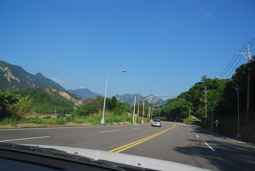
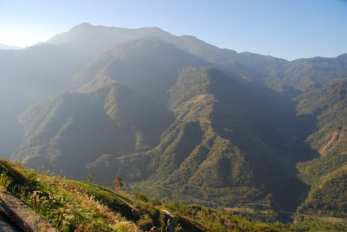
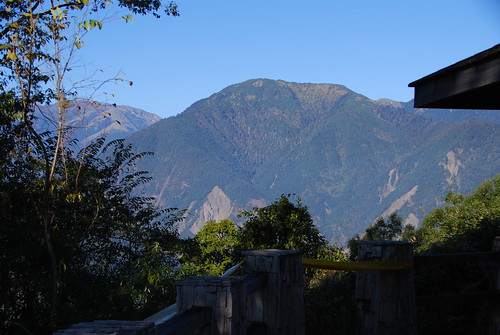
We set out from Kaohsiung and drove up towards Tainan, cutting east and then onto Highway 20 just outside of Tainan. The weather was absolutely perfect! See those mountains in the distance? We got a lot closer to them!
Please note that I’ve geotagged this article at the point where we picked up Highway 20 outside of Tainan.
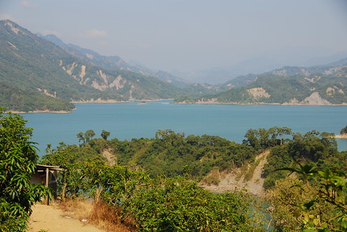
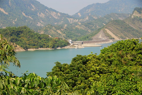
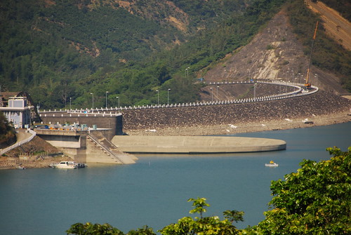
There is a huge reservoir east of Tainan and we drove right past it.
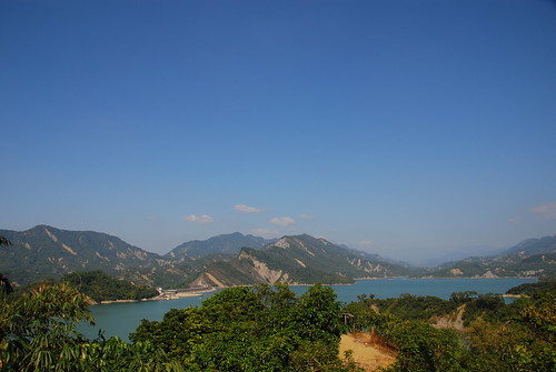
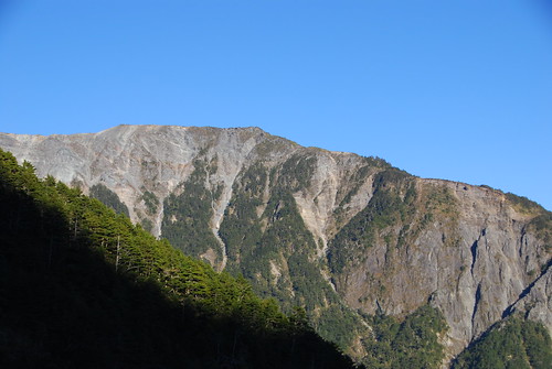
Those are actual colors we saw with our eyes. Notice the deep rich dark blue color of the sky. I told you it was a fantastic day for traveling and taking photographs!
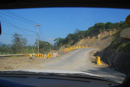
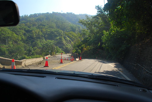
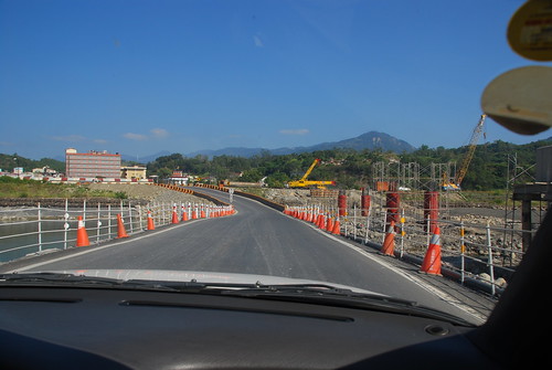
This highway is under constant construction as earthquakes and typhoons wipe it out continuously.
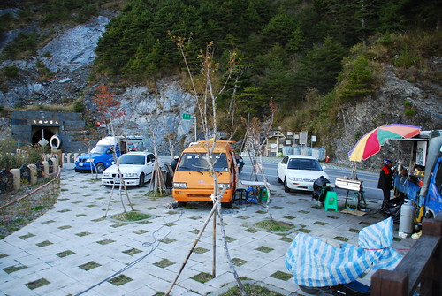
In some places the construction was quite manageable….
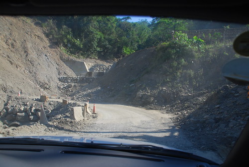
….and in other places the construction areas were pretty scary….
But driving through these wonderful mountains was well worth the effort.
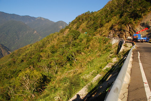
This shot gives the viewer a little dose of perspective as we stood next to a guardrail. At this point we’re well over 1,000 meters altitude.
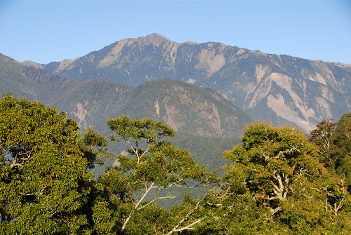
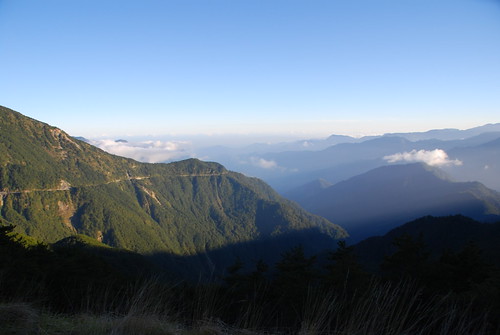
These shots were taken at over 2,000 meters high, at a small overlook on the road. It was rather cool up this high, I can assure you. The air was clean and pure. At this point, we had over 4 hours of travel invested in this highway.
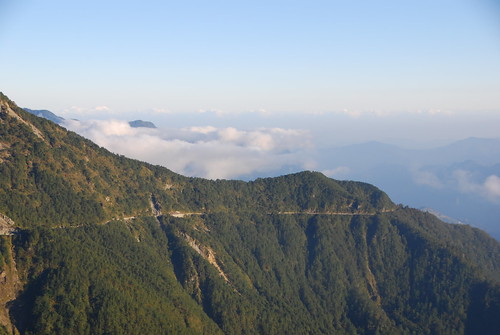
Finally we reached the highest point on the highway, and we pulled over at a little rest stop. In Taiwan you’ll hear outdoorspeople talk about “the land above the clouds” and this is because frequently, one may find themselves above the clouds, looking down on them as this photo illustrates.
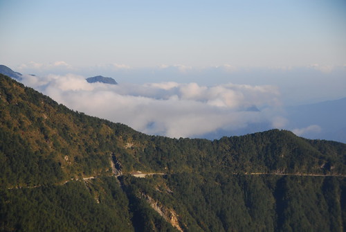
That little light line is the road we’re going to be driving on shortly.

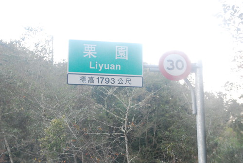
We passed through this tunnel just before we pulled over to take a few minutes to rest. The sign says “2722 meters” altitude. That’s 8930.419 feet. This is considerably higher than New Hampshire’s Mt. Washington at 6,288 feet.
Several people had stopped to enjoy some hot soup or a beverage.
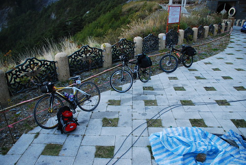
We saw a couple groups of mountain bikers on the road with us. It’s going to be quite some time before I’m ready to take my new recumbent trike up there! But I would love to try it.

A couple bikers take a break.
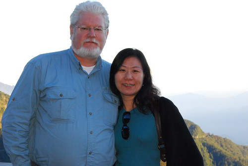
Most of the time Hui-chen and I travel alone, so this time we took advantage of our friend David being along with us and asked him to snap a photo of us together.
After more than 5 hours of driving, we finally were on the descent on the other side of the divide.
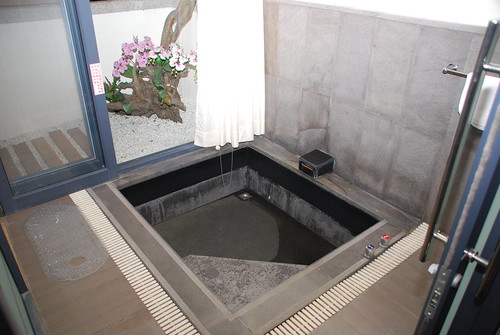
This is what awaited us – our hotsprings hotel. This is the private bath in our room. After that grueling ride though the mountains, we spent some enjoyable time in the hotsprings bath. Sound good?
Thanks for reading. Be sure to leave us a rating on this article!
MJ really beautiful pictures. It did look like a fantastic day for travelling in the mountains. Some of the roadwork areas looked very dodgy.
The cyclists were keen, that would be a hell of a ride for them. A few hours in the saddle. I seen two of the bikes had road tyres and one had offroad tyres on. Are drivers in Taiwan courteous to bike riders? In Australia most drivers are absolute assholes.
The hotel looked like a good place to recharge the batteries after the long drive. Sitting in the bath with a cool sangsom, soda and lime 🙂
Bruntys last blog post..Thai sport day outfits, Isaan Thailand.
Brunty » in general, Taiwanese motorists are very courteous to bicycle riders. i found that a welcome change from US motorists.
the bath was very relaxing and worth the effort.
Great photos, I love that road.
Did that route not too long ago, but somehow missed some of the spots you mentioned.
Where was that hotsprings hotel located at?
Fili » the Sansiantai and the Water Running Uphill are not actually on Highway 20, and neither is the hotel. the hotel we went to is about 35 km south of the intersection of 20 with Route 9.
I took this exact same route this summer from Tainan to Chishang via Highway 20. Definitely some of the most beautiful mountain scenery in Taiwan, but also one of the worst roads I had ever experienced. And driving through the one-lane tunnel at Yakou with no lights was slightly terrifying since the light indicator for oncoming traffic was not working. Did you stop in Chishang to enjoy the famous “Chishang bento”?
Kevin » that tunnel is a trip! for a moment i thought we were in a mine instead! no we didn’t stop at Chishang, so we have more things to try out later. thanks.
and even more beautiful pics in this article. What a cool ride.
Ashishs last blog post..A long weekend in Sanxia
Ashish » it is a great ride! you should take that highway yourself (in a few months from now of course 😉 ). the highway was under construction quite a bit but it was passable without much difficulty.
Some beautiful countryside down there. Another one of Taiwan’s gems.
cfimagess last blog post..Chen Shui-bian
cfimages » isn’t that the truth! every time we rounded a corner, i was saying “wow! look at that!” thanks Craig.
Thanks for the nice post. I was persuaded out of driving the highway back to the west side this Oct. The reasons given are 1. it was too late about 3 in the afternoon and 2. it’s usually very foggy up there. Reading your post, I know better how to plan my trip. Thanks.
nancy » i also heard that it gets foggy up there, but we didn’t see it ourselves. i would definitely not want to do that road at night under any circumstances. as it was, we were in the foothills at dusk and we did have to wind around in the dark. we just took it nice and slow. if i had to do it again, i would have started out a bit earlier. hope you get to try Highway 20 sometime soon! thanks for your comments.